TopWaterfrontDeals.com Daniel G. Starowicz, P.A.  Realtor, 239-603-6100

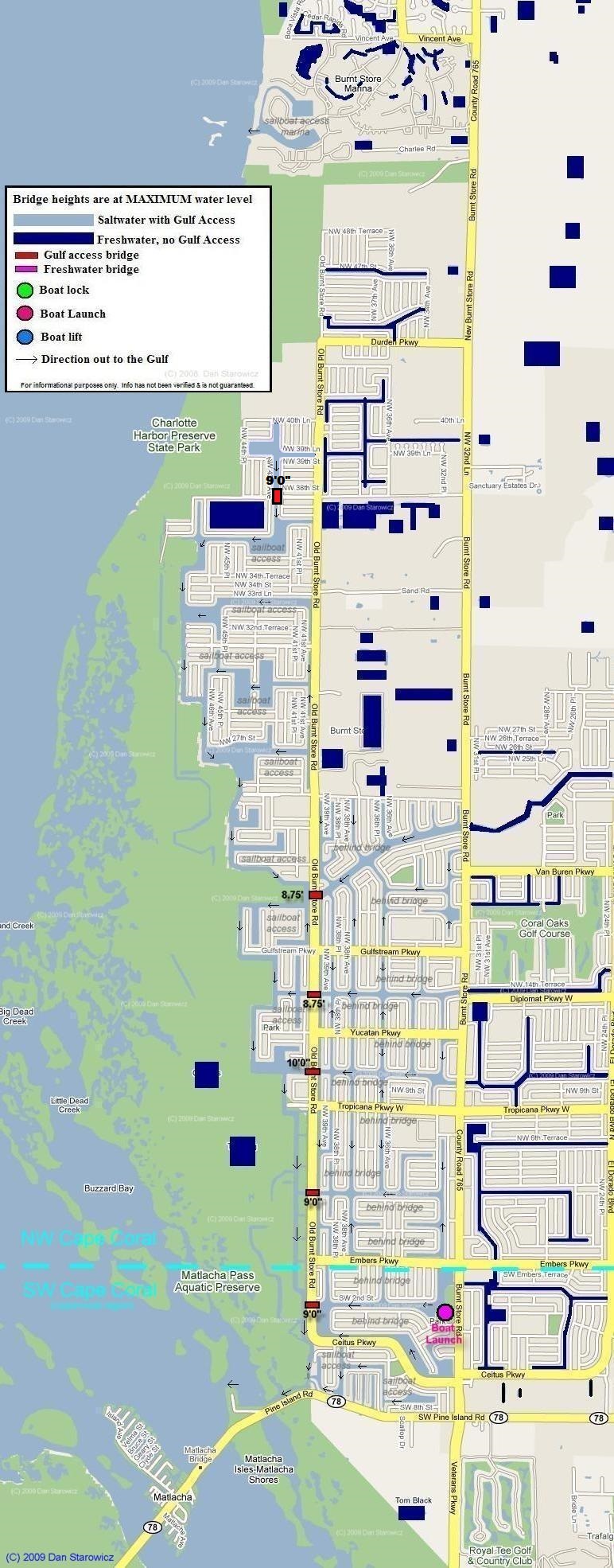
Map of Northwest Cape Coral’s Canal System

This map includes bridge heights and locations, it denotes which canals are freshwater and which are saltwater (offering Gulf Access), where the sailboat access canals are, and also the locations of the city’s locks, lifts, and boat ramps.  A legend is included below. The internet’s only source for this info!

This is a very large image and may take a minute to load.

NW Cape Coral
Map of Northwest Cape Coral Florida includes locations and heights of Bridges, boat locks and boat lifts as well as the location of saltwater and freshwater canals includes Burnt Store Marina and Matlacha Pass

Continue to the next page: “Cape Coral homes behind bridges” >>

You are viewing a page included in the Southwest Florida Real Estate Guide.  Click on next page button to continue.

Not viewing the pages in sequence? You can start at the beginning of the guide by clicking here.

prev page
Return to the Southwest Florida Guide's Index Page Next Page

Above Map overlays Courtesy Google Maps